Potential Snowfall in Metro Vancouver
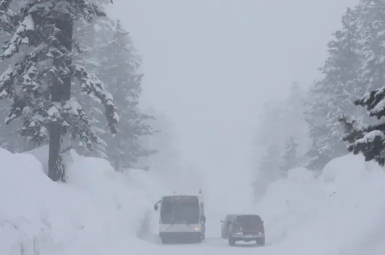
Environment Canada has issued a special weather statement for Metro Vancouver, warning residents of potential snow through Wednesday. This weather event is expected to disrupt commutes across the region, with snowfall accumulations varying significantly.
Flurries or rain showers are anticipated from Monday through Wednesday morning, with snowfall expected to be more pronounced at higher elevations. In Metro Vancouver, snowfall accumulations are predicted to range between two and five centimetres, while areas at higher elevations could see up to eight centimetres.
Impact on Commuters
Drivers are advised to allow for extra time during their morning commutes due to the likelihood of travel delays. A cool and unstable airmass over the South Coast will bring freezing levels close to sea level before Tuesday morning, exacerbating the potential for hazardous driving conditions.
Commuters are urged to prepare for the possibility of snow impacting their travel plans, as snow is expected to make a late-winter visit to southwestern British Columbia. The provincial Transportation Ministry has also recommended that drivers equip their vehicles with winter tires to ensure safety on the roads.
Current Weather Context
Interestingly, Vancouver has yet to record a measurable snowfall this winter at the city’s airport, marking a notable absence of significant winter weather thus far. The special weather statement applies to several cities within the region, including Vancouver, Burnaby, and New Westminster.
As of now, approximately 1,300 customers in Northern B.C. are affected by power outages, with 21 outages reported. These disruptions are likely linked to the adverse weather conditions impacting the area.
Details remain unconfirmed regarding the exact timing and extent of the snowfall, but residents are encouraged to stay informed as the situation develops.