Introduction
As wildfires continue to ravage various regions of Canada, the importance of tracking air quality through a wildfire smoke map has become increasingly vital. These maps provide crucial information about smoke dispersion, helping citizens stay aware of health risks associated with poor air quality.
The Impact of Wildfires
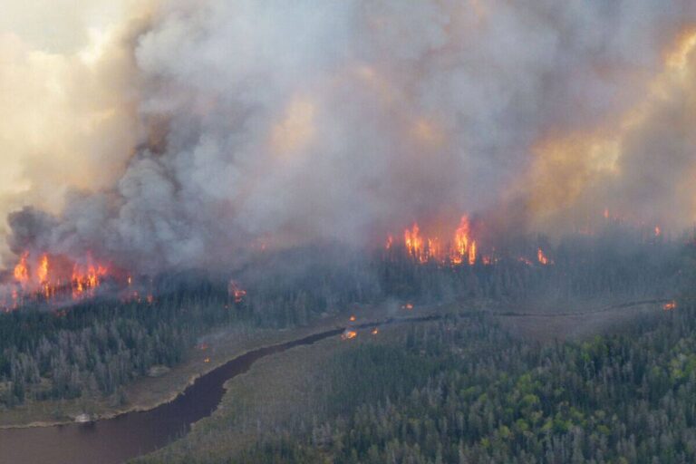
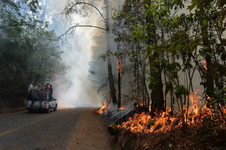
This year, record-breaking heat and drought conditions have fueled some of the largest wildfires in Canadian history, particularly in British Columbia and Alberta. According to the Canadian Interagency Forest Fire Centre, over 7,000 square kilometers have burned this season alone. These fires release significant amounts of particulate matter into the atmosphere, leading to health risks such as respiratory issues, particularly for vulnerable populations.
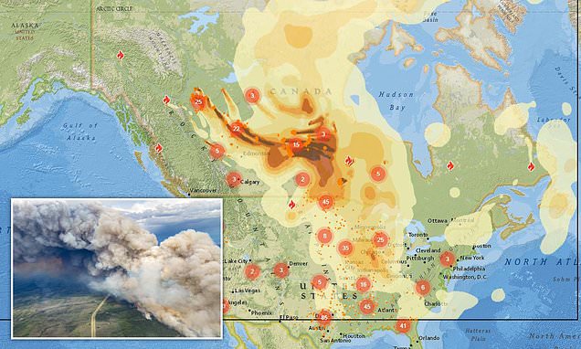
The Wildfire Smoke Map
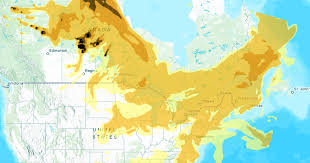
The wildfire smoke map is a satellite and ground-based effort that visualizes smoke coverage across Canada. The map updates in real-time, using data from Environment and Climate Change Canada alongside advanced satellite imagery. Users can access this resource online to check smoke levels in their area, as well as predicted movements of smoke over the coming days.
This interactive tool allows users to zoom in on their specific region, view air quality index readings, and forecast potential health advisories. Individuals and families can use the map to make informed decisions, especially regarding outdoor activities during high smoke days.
Recent Updates
As of mid-October 2023, wildfires continue in several provinces. The smoke map illustrates how smoke from these active fires has drifted across large parts of eastern Canada, affecting cities like Toronto and Montreal. Experts recommend wearing masks outdoors and limiting strenuous activities when air quality is poor. Moreover, Environment Canada has issued several alerts advising residents to stay indoors as smoke concentrations remain high.
Conclusion
As climate change exacerbates the frequency and intensity of wildfires, tools such as the wildfire smoke map are essential for protecting public health. Awareness of air quality levels can greatly influence behavior during wildfire season. It is crucial for all Canadians to stay informed, as the smoke does not only affect those near the fires but can drift hundreds of kilometers away.
In summary, keeping an eye on the wildfire smoke map and following health advisories will enable individuals to safeguard their well-being effectively. With continued advocacy for wildfire management and climate action, future generations will hopefully enjoy clearer skies and healthier air.