Introduction
With wildfires becoming an increasingly frequent threat across Canada, especially in regions like British Columbia and Alberta, fire maps have become an essential tool for residents, firefighters, and emergency management agencies. A fire map provides important information about current fire conditions, including locations of active fires, areas at risk, and updated evacuation zones. Understanding how to read and utilize fire maps can be crucial for safety during wildfire season.
The Importance of Fire Maps
Fire maps serve multiple purposes. They help inform residents about the proximity of wildfires, allowing them to make informed decisions about evacuations and protective measures. These maps are continually updated with data from satellite imagery, ground reports, and weather forecasts, making them a real-time resource during emergencies. Additionally, fire maps assist firefighters in strategizing their response to fires, highlighting areas of concern and guiding resources efficiently.
Current Situation in Canada
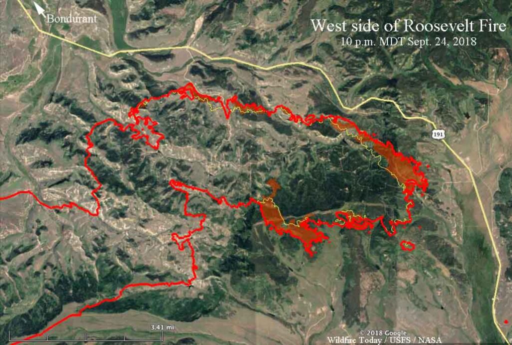
As of the summer of 2023, Canada has faced one of its worst wildfire seasons on record, with over 7 million hectares burned across the country. Provinces such as Ontario, Newfoundland and Labrador, and British Columbia have experienced extensive fire activity, prompting the use of fire maps to monitor and manage the crisis effectively. Authorities are urging residents in high-risk areas to stay informed through reliable fire maps published by agencies such as Natural Resources Canada and provincial wildfire management offices.
Accessing Fire Maps
Residents can access fire maps through various platforms. Official government websites provide interactive maps that display real-time fire activity and forecasts. There are also mobile applications that send alerts about nearby fires, further enhancing community preparedness. By leveraging these technologies, individuals can stay updated and make faster, safer decisions in the face of wildfire threats.
Conclusion
In conclusion, fire maps are a vital resource that not only enhances public safety during wildfire incidents but also aids in effective fire management strategies. As the frequency and intensity of wildfires continue to rise due to climate change, understanding and utilizing fire maps will be even more critical. For Canadians, staying informed and prepared is key, making fire maps an indispensable tool in the fight against wildfires.