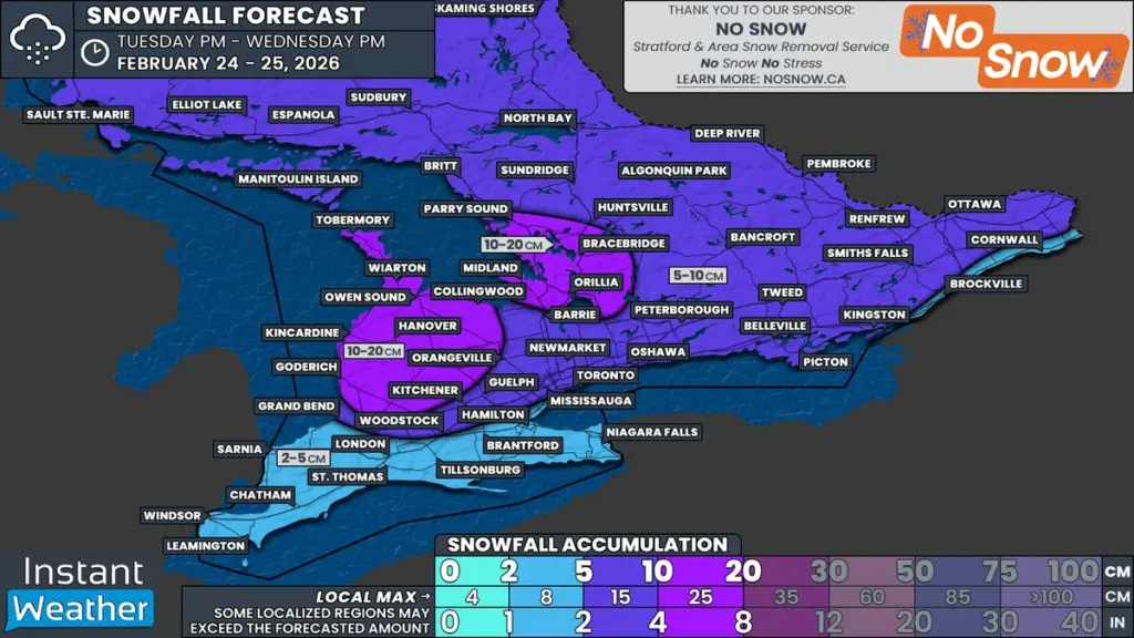
What Happened
As February draws to a close, Southern Ontario is bracing for an Alberta clipper that is expected to bring widespread snowfall overnight from Tuesday into Wednesday. The snowfall is forecasted to accumulate between 5 to 10 cm, with localized areas potentially receiving up to 15 cm. This weather system is anticipated to coincide with the Wednesday morning commute, raising concerns about travel conditions.
Why It Matters
The timing of the snowfall is particularly concerning as it will likely cover roads during peak travel hours, leading to slippery conditions and reduced visibility. Wind gusts of 40 to 60 km/h may exacerbate these issues by causing blowing snow, especially in exposed areas near Lake Huron and Georgian Bay. Additionally, the potential for lake effect snow could result in further accumulation throughout Wednesday, particularly in traditional snowbelt communities.
What’s Next
Local school boards may consider canceling bus services due to the anticipated weather conditions. However, the decision will depend on how effectively road crews can clear the snow overnight and whether the snowfall subsides before morning. While snowfall totals are generally manageable, the combination of snow and wind could lead to significant travel disruptions.