Weather Conditions Before the Warning
Prior to the issuance of the yellow warning, weather forecasts for southern Ontario indicated a series of low-pressure systems approaching the region. These systems were expected to bring varying weather conditions, but the extent of the rainfall was not fully anticipated.
Decisive Changes in Forecast
Environment Canada has now issued a yellow warning for Windsor-Essex due to heavy rainfall in the forecast. Rainfall amounts of 20 to 40 mm are expected in Windsor-Essex, with higher amounts possible in areas that experience thunderstorms. This marks a significant shift from earlier expectations.
Impact on Surrounding Areas
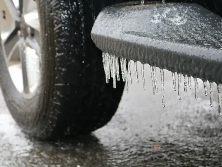
In addition to Windsor-Essex, multiple weather warnings for freezing rain and rainfall are now in effect for the Kawarthas region starting March 10. Yellow warnings for rainfall are also in effect for Peterborough County, Kawartha Lakes, and Northumberland County, where similar rainfall amounts of 20 to 40 mm are anticipated.
Niagara is under a yellow rainfall warning as well, with forecasts predicting up to 40 millimetres of rain. This situation raises concerns for local residents and authorities alike.
Consequences of Heavy Rainfall
The saturated or frozen ground in these areas will have little ability to absorb the rainfall, leading to pooling on roadways and localized flooding. Rain is expected to start late tonight in Niagara and continue overnight, with a brief break tomorrow morning, further complicating travel and outdoor activities.
Expert Perspectives
Experts warn that the combination of heavy rainfall and already saturated ground conditions could lead to significant flooding risks. Local authorities are advising residents to prepare for potential disruptions and to stay informed about changing weather conditions.
As the situation develops, residents are encouraged to monitor updates from Environment Canada and local news sources for the latest information on the weather and safety advisories.